Paths for Water
The Shirakawa is a major river that collects waters from the Aso caldera and carries them out to the Ariake Sea. Kikuyo is an excellent place to experience all that the Shirakawa offers and provides to the entire Kumamoto Prefecture. A close look at the Shirakawa river basin reveals a unique, almost tadpole-like shape, with Aso as the head. This shape is believed to be due to the distribution of seismic faults running east-west in central Kyushu. Although the Shirakawa runs through many towns, it was necessary to build aqueducts to bring the water to where it was needed.
The Babagusu Ide said to be built under Kato Kiyomasa provides water to the southern side of the Shirakawa River, and the Seta Uwaide/Shitaide, Tsukure, and Tamaoka Canals lie to the north. The canal waters are vital for daily life and agriculture, and it is no exaggeration to say that the canals that criss-cross the town are the paths for water that form the foundation of Kikuyo.
The canals built under the Katos and the Hosokawas are still in use today. Also, the weirs and bridges built around the canals are very important cultural assets.
Paths for Water : COURSE
Six Weirs and Seven Canals
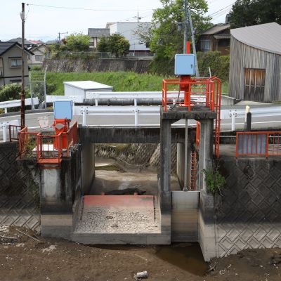
To utilize the waters of the Shirakawa, six weirs (a dam-like structure that regulates waterflow without retaining water) and seven canals were built in the mid-Shirakawa basin. Even now, most of the canals are still used for irrigation. The Hanaguri Ide was constructed with some of The Edo Era's most advanced techniques, and the Seta Uwaide and Babagusu Ides intake were constructed with old masonry techniques.
Stone Bridges and Canals
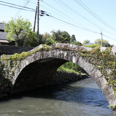
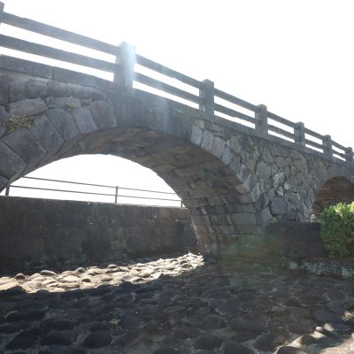
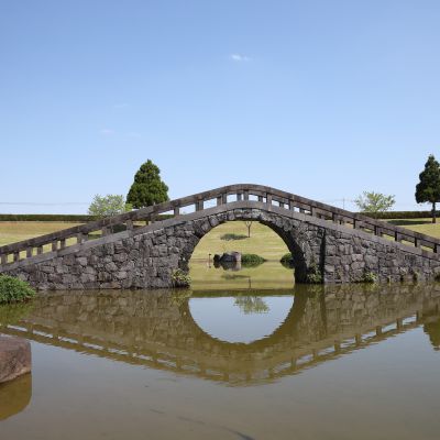
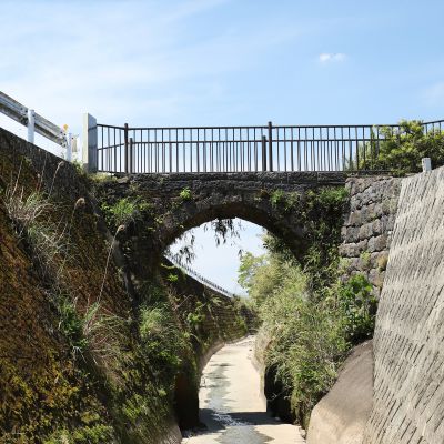
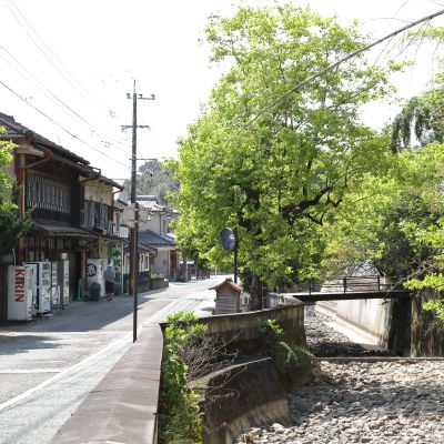
Due to the excavation of numerous canals, bridges to get over the canals became necessary. A number of stone bridges ("meganebashi," meaning "spectacle bridge" due to their resemblance to glasses) constructed over canals in the late-The Edo Era and early-Meiji periods (around 1800-1900) still exist in Kikuyo and Ozu. The Uwaide Canal is surrounded by a townscape developed through a close historical relationship with the water around it.
Short Course
- Hanaguri Ide Park6.8Km
- Babagusu Ide Inlet13.2Km
- Iguchi Meganebashi3.2Km
- Kamitsukure Meganebashi13.2Km
- Kogabaru Meganebashi15.2Km
- Nyudomizu Meganebashi0.3Km
- Sanfurea
These cultural sites related to river improvement and irrigation take you through the canals and bridges built by Kato Kiyomasa and the lords of the Hosokawa clan, as they have been used for centuries.
Long Course
- Hanaguri Ide Park6.4Km
- Iguchi Meganebashi3.2Km
- Kamitsukure Meganebashi10.8Km
- Babagusu Ide Inlet1Km
- Tsukure Weir12.6Km
- Sako & Tamaoka Weir18Km
- Hataide Weir3Km
- Uwaide Weir2.4Km
- Shitaide Weir16.8Km
- Tanbo no Haki2.8Km
- Uwaide & Tomachisuji6.4Km
- Kogabaru Meganebashi15.2Km
- Nyudomizu Meganebashi0.3Km
- Sanfurea
Paths for Water : MAP
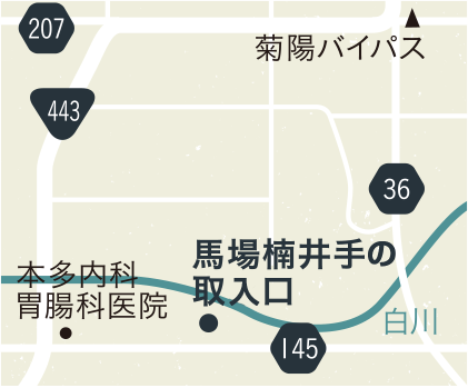
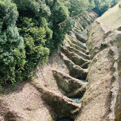
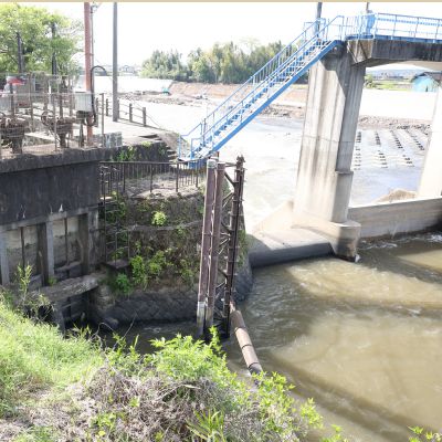
4Babagusu Ide Inlet
Start-up GPS
お使いの端末のGPS機能の利用を許可すると現在地の表示や、
目的地までのルートを表示することが出来ます。
Inlet Built By Ingenuity Of Kato Kiyomasa
This inlet was supposedly built in 1608 by Kato Kiyomasa in order to turn the left banks of the lower Shirakawa into rice paddies. What makes the inlet unique is how it was built with indentations carved into the stone so that only a specific amount of water could flow in, and so dirt and sand is agitated to keep it from building up on the bottom of the canal.
- Yes
- No