Paths for People
Kikuyo lies at a key point along routes connecting Kumamoto, Aso, and Oita, and is home to many historical roads where people and products made there way along for centuries. The Bungo Kaido, known for it's cedar-lined section in Ozu, is the most famous of the historical roads, while others still act as important routes for the daily lives of residents. Many of these old roads are still in use today, with stone monuments erected along the roads offering glimpses into the history of the area.
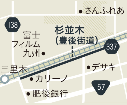
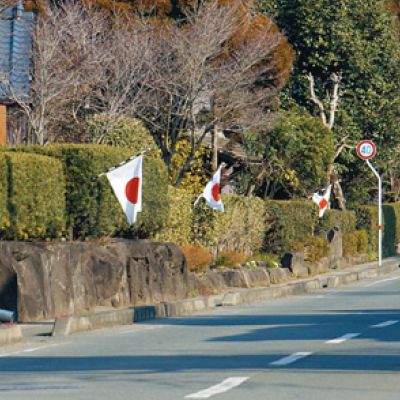
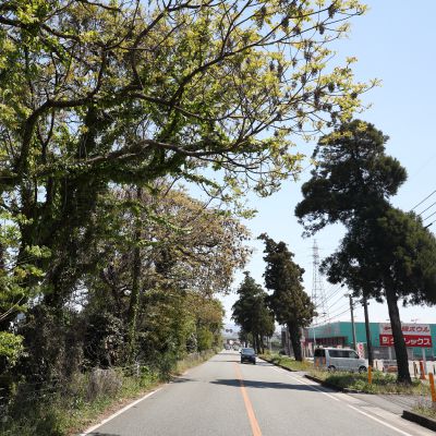
The Bungo Kaido, an old road used by nobility when traveling to the capital, is one of the main historical roads of Kumamoto, and is up to 40 meters wide at its widest. It currently acts as a major regional roadway. The route passes along many famous locations, including Musashizuka Park, home to the gravesite of the master swordsman Miyamoto Musashi, who was invited by Hosokawa Tadatoshi to act as instructor of military strategy.
The Nango Okan was also an economically important thoroughfare linking Akita-fu, the capital of Higo (modern day Kumamoto Prefecture), to Nango in Aso and Taketa in Oita. This route fell out of use with the creation of Route 57, but taking a stroll along the moss-covered cobblestones gives you a good idea of the historical splendor this road once enjoyed.
There exists a number of other roads that still act as cultural heritage sites and important thoroughfares for local residents, such as the Takaba Okan that connects Ozu with Takaba in Koshi.
Paths for People : COURSE
The Kaido and Local Life
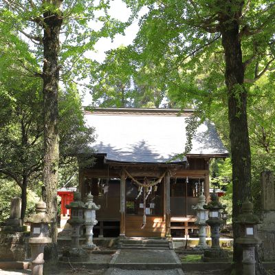
On the north end of the Bungo Kaido was built a village called Teppo Koji for a group of arquebusiers (gun warriors). The village was built to both protect from enemies and as a new development on undeveloped land. Amazingly, the approximately 4 kilometer-long hedge that ran along the samurai residences is still in tact. The Sokotsuru Shrine in the village was designated by Aso Shrine as home to the protective deity for the village.
Vestiges of Sankin Kotai: A Post Town
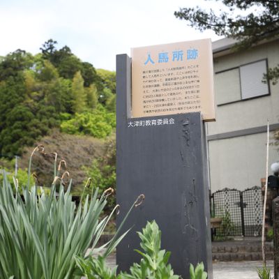
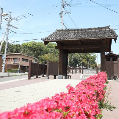
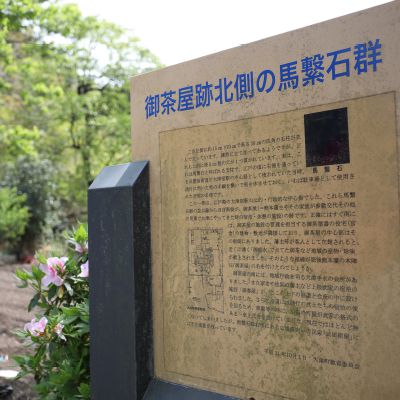
The town of Ozu was a prosperous regional center, as it was a post town for the Sankin Kotai, a regular and required visitation of regional lords to the capital, and it was also home to the government offices for the region. The town features a number of interesting historical spots, including the site of a teahouse where lords rested and lodged; the Murosutoguchi Gate, which was a temporary checkpoint that functioned to ensure the safety of the lords as they traveled; and the Jinbasho, the site of a relay station used to transport the annual rice tax.
Short Course
- Sanfurea1.3Km
- Rai Sanyo Monument4Km
- Hazenoki Namiki5.6Km
- Teppo Koji5.6Km
- Sokotsuru Shrine8.4Km
- Sanrigi & Yonrigi3.2Km
- Sanfurea
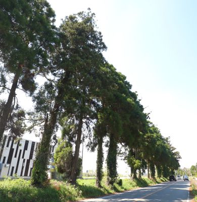
The famous cedar-lined Bungo Kaido was always bustling with people and goods being moved, and as such boasts a storied history.
Through the vestiges of being a prosperous post town, a residence for gun warriors to protect the
road, and a place where so many travelers passed through, there are so many cultural assets with historic associations to these roads.
Long Course
- Musashizuka Park11Km
- Hazenoki Namiki4Km
- Rai Sanyo Monument1.3Km
- Sanfurea3.2Km
- Teppo Koji5.6Km
- Sokotsuru Shrine7.8Km
- Sanrigi & Yonrigi4.2Km
- Site of Murosutoguchi Gate5.1Km
- Ozu History and Culture Tradition Museum0.3Km
- Site of Relay Station1.2Km
- Site of Ozu Tenaga Hall0.4Km
- Site of Ochaya1.2Km
- Site of Okura1.5Km
- Kiyomasa Road & Gorigi Site4.5Km
- Ozu Roadside Station
Paths for People : MAP
7Sanrigi & Yonrigi
Start-up GPS
お使いの端末のGPS機能の利用を許可すると現在地の表示や、
目的地までのルートを表示することが出来ます。
Symbol of Bungo Kaido Planted by Kato Kiyomasa
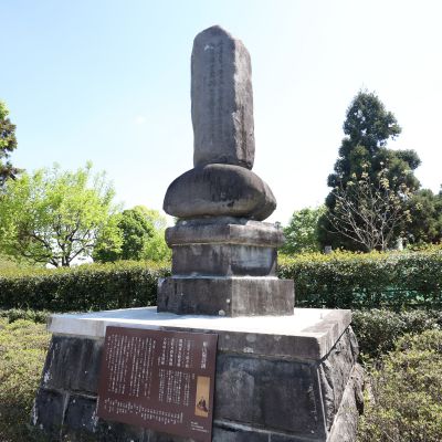
These cedars brought from Yakushima by Kato Kiyomasa to line the Bungo Kaido (current Route 337), were so well protected that it was said that in the early The Edo Era, breaking a single branch should be paid for with loss of a finger, and that cutting down an entire cedar should be punishable by death. In the Haramizu area, populated by relatively older trees, there once stood a tree marking 4 ri (about 16 kilometers) from Kumamoto Castle, but the tree is no longer standing and a stone monument stands in its place.
- No
- No